|
We are an
Atlanta, GA U.S.A. small business, you can call us and speak to a
live
person U.S.A. REGIONAL BUSINESS MAPS DETAILED U.S.A. REGIONS CITY COUNTY MAPS LARGE UNITED STATES MAP The most detailed USA wall map!
U.S.A.
COUNTY LINES Hardcopy WALL MAPS important tools for business
Download Maps on sale
40% off! |
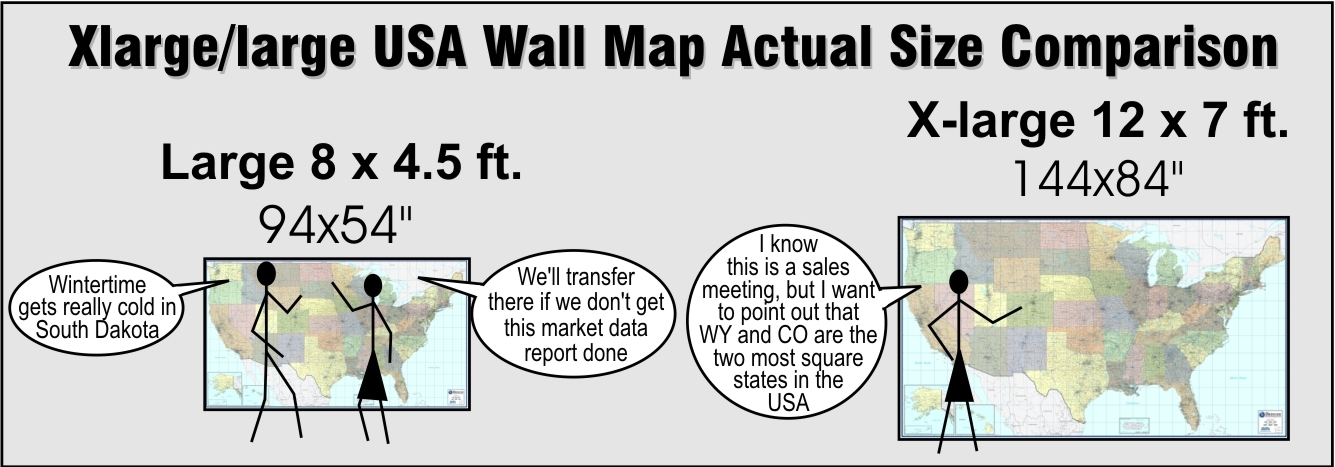
UNITED STATES LARGE WALL MAP LAMINATED
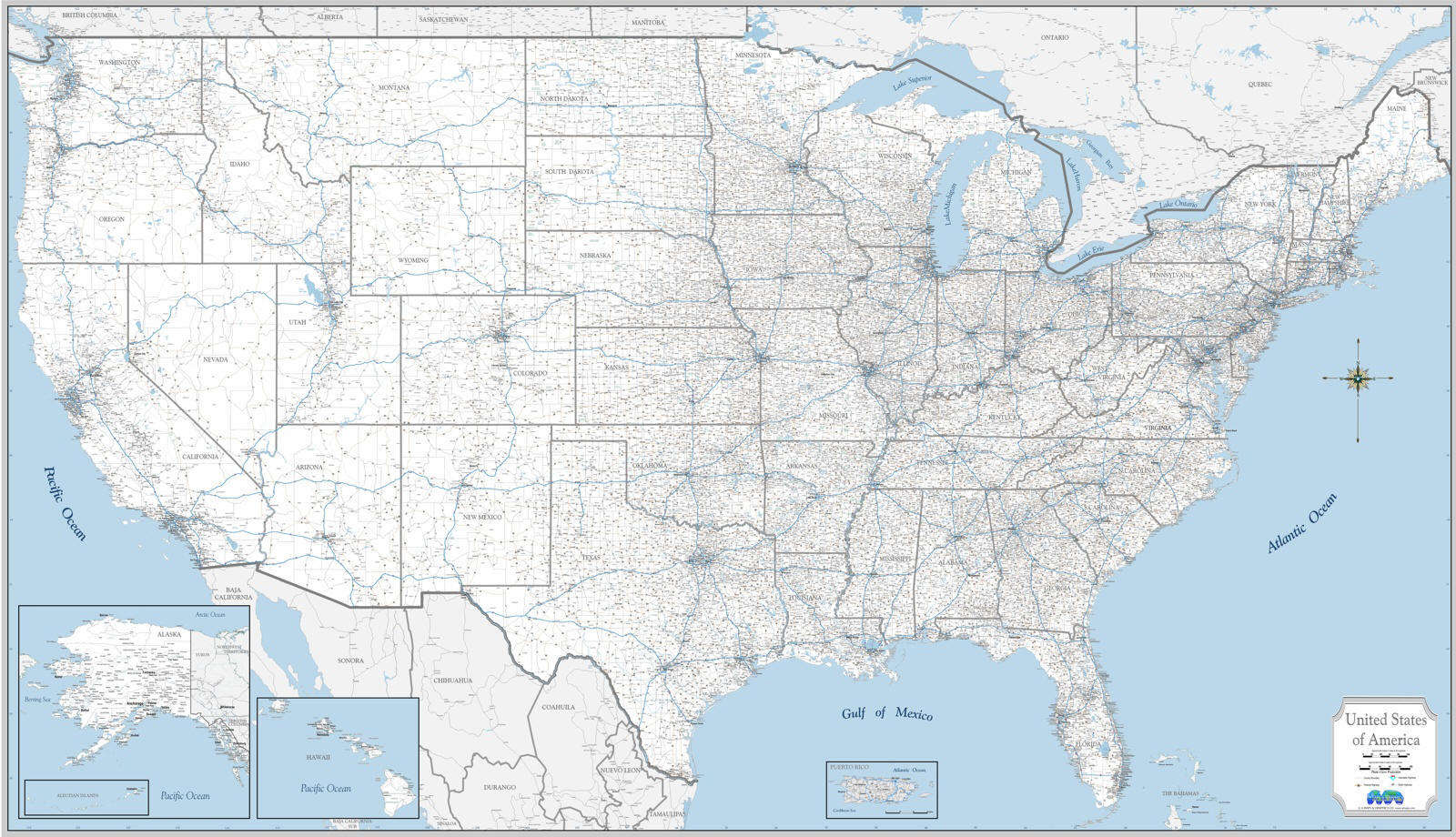
- USA Counties, 25,000 Place names, major highways, waterways and more - the most detailed wall map of the USA,
designed for business office, but adaptable to the study, man cave or RV!
White background minimalist style-
one of
5 background colors available
PROFESSIONAL EXECUTIVE SERIES LARGE USA ATTRACTIVE, INFORMATIVE, IMPRESSIVE
Wall Map of the United States, large, laminated, and beautifully designed for the executive business office, available in 3 sizes, with choice of background coloring to compliment the setting. Professional Commercial Maps provide both useful information and quality décor as an art display for any office, conference room or reception/lobby area wall. We make real maps, from the actual cartography to printing and laminating, all in-house by Americans, right here in the USA. Compare our detail level and aesthetics to any commercial style wall map available.
With the most detail available on any U.S. wall map, nothing beats being able to see the big picture. This large United States office wall map includes the Interstate and US Federal highways, even major state highways and prominent water features. All USA counties or parishes are outlined with names, plus more than 20,000 cities and towns are labeled! Limited detail in Canada and Mexico, and at the bottom are insets for Alaska, Hawaii and Puerto Rico. Perfect for sales territories, market research and planning, distribution and logistics, and for tracking growth and expansion. Check our new sales and marketing series County-Town series maps if you prefer a smaller size or less detail and see information about framing. Super detailed In your choice of background color schemes:
- White background - Minimalist style, very utilitarian, great for marking territories or routes in your own colors
- Industrial style - Urban concrete Greige Map contrasting neutral tones
-
County-toned-contrasting-color-by-state NEW exclusive!
Very colorful map style never seen before! Makes counties extremely easy to decipher, even while showing the high level of detail. - Traditional - classic political style contrasting color by state
- Topographic color map - Earth tones by elevation, popular choice for environmental and travel planning
Each version is easy to read despite the abundant amount of information and necessary smaller text, and beautifully decorative, to coordinate with your décor style. This wall map can be just as at home actually at home, as it is on an office wall, a great addition to your man-cave, den, library, study, home office, game room (near the dart board?) or even on the ceiling of your RV!