|
We are an
Atlanta, GA U.S.A. small business, you can call us and speak to a
live
person U.S.A. REGIONAL BUSINESS MAPS DETAILED U.S.A. REGIONS CITY COUNTY MAPS LARGE UNITED STATES MAP The most detailed USA wall map!
U.S.A.
COUNTY LINES Hardcopy WALL MAPS important tools for business
Download Maps on sale
40% off! |
State Laminated Office Wall maps designed for business
NEW STATE OF GEORGIA COMMERCIAL
WALL MAP
Super detailed- NAMED MAJOR ROADS!
Large
Laminated
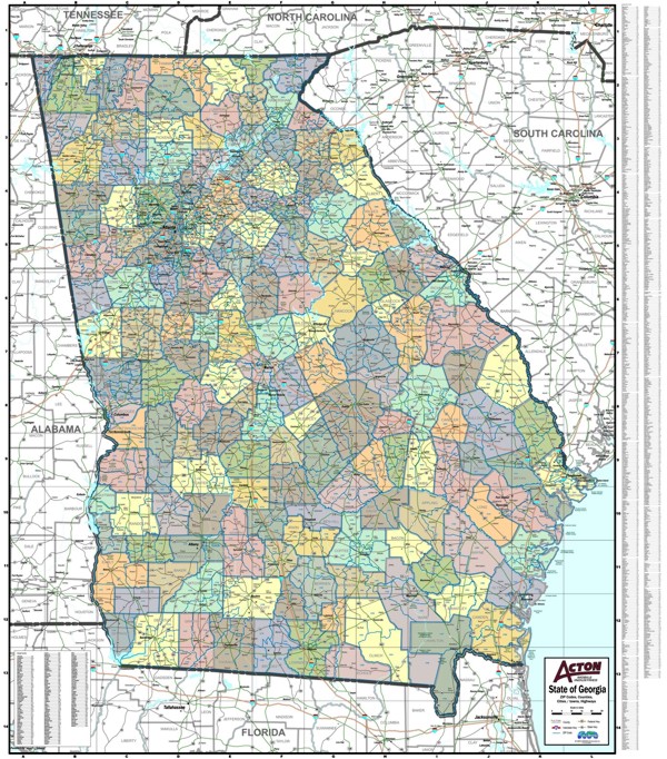
Showing primary streets, Highways, Counties in contrasting colors,
Parks, Water Features, Surrounding States, Major Railroad lines,
Cities, Towns, Highway Exit Numbers. Counties and Cities
are
index across bottom. Laminated both sides.
The most detailed commercial wall map ever made for the
State of Georgia, utilized by business and government offices.
OR
Georgia State wall map same detail as above -highways, exits,
cities, counties, but no major streets.
Choose 3 sizes, background white or color, county and city only,
or including 5-digit ZIP codes with boundaries.
NEW! WALL MAPS laminated,
indexed by cities and counties
color by county or white background
SOUTH CAROLINA
TENNESSEE
5-Digit Zip Code Wall Maps for all 50 states
and Every Metro area city in the USA!
Detailed, up-to-date marketing maps with zip codes are plotted per order from a unique custom GIS programmed database. These attractive and informative full-color wall maps are indexed and laminated. Available in SEVERAL sizes.
We can create Custom Maps From our own map database.
Map tacks/Pins, foam board mounting, laminating, custom framing
Large Maps Mounted on foam board and framed must be shipped by truck
Copyright A-Maps and Graphics
Phone: 770-443-8808 contact us